Geophysical Center of the Russian Academy of Sciences, Moscow, Russia
World Data Center for Solid Earth Physics
The Geotraverse Project
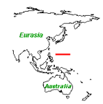
The Philippine Sea Geotraverse

Sample Information
HEINJR8701
compiler: NGDC
checked?: X
institution: U.S. Geological Survey-Menlo Park
laboratory: USGS
ship name: Thomas Thompson
cruise id: TT-192
sample identifier: D11-1-A
subsample no: 1
NGDC sequence no: NM001926
sampling device: Unspecified Dredge/Drag Haul
water depth (m): 1380
decimal latitude: 19.4550
decimal longitude: 145.4907
navigation method: unknown
collection date: 1985 (YYYYMMDDHHHH)
sample weight: 450
weight units: kilogram
L.O.S. ocean area: N.MARIANA-GUAM
jurisdiction: U.S. EEZ
feature type: Seamount
feature name: CHEREF SEAMOUNT
sample type: stratiform deposit
section type: unknown
water loss: 3.900
water loss modifier undetermined
HEINJR8701
compiler: NGDC
checked?: X
institution: U.S. Geological Survey-Menlo Park
laboratory: USGS
ship name: Thomas Thompson
cruise id: TT-192
sample identifier: D3-3
subsample no: 1
NGDC sequence no: NM001937
sampling device: Unspecified Dredge/Drag Haul
water depth (m): 2975
decimal latitude: 17.1483
decimal longitude: 145.6567
navigation method: unknown
collection date: 1985 (YYYYMMDDHHHH)
sample weight: 6
weight units: kilogram
deposit type: strat.
L.O.S. ocean area: N.MARIANA-GUAM
jurisdiction: U.S. EEZ
photo type: B&W still
feature type: Rift/Ridge/Rise
feature name: SW GUGUAN RIDGE
sample type: stratiform deposit
section type: fragments or pieces
water loss: 4.600
water loss modifier undetermined
HEINJR8701
compiler: NGDC
checked?: X
institution: U.S. Geological Survey-Menlo Park
laboratory: USGS
ship name: Thomas Thompson
cruise id: TT-192
sample identifier: D8
subsample no: 1
NGDC sequence no: NM001972
sampling device: Unspecified Dredge/Drag Haul
water depth (m): 2880
decimal latitude: 19.1495
decimal longitude: 145.4983
navigation method: unknown
collection date: 1985 (YYYYMMDDHHHH)
sample weight: 300
weight units: kilogram
L.O.S. ocean area: N.MARIANA-GUAM
jurisdiction: U.S. EEZ
photo type: B&W still
feature type: Seamount
feature name: POYO SEAMOUNT
sample type: unknown
section type: unknown
water loss: 1.500
water loss modifier undetermined
HEINJR8701
compiler: NGDC
checked?: X
institution: U.S. Geological Survey-Menlo Park
laboratory: USGS
ship name: Thomas Thompson
cruise id: TT-192
sample identifier: D8
subsample no: 2
NGDC sequence no: NM001973
sampling device: Unspecified Dredge/Drag Haul
water depth (m): 2880
decimal latitude: 19.1495
decimal longitude: 145.4983
navigation method: unknown
collection date: 1985 (YYYYMMDDHHHH)
sample weight: 300
weight units: kilogram
L.O.S. ocean area: N.MARIANA-GUAM
jurisdiction: U.S. EEZ
photo type: B&W still
feature type: Seamount
feature name: POYO SEAMOUNT
sample type: unknown
section type: unknown
water loss: 4.700
water loss modifier undetermined
HEINJR8701
compiler: NGDC
checked?: X
institution: U.S. Geological Survey-Menlo Park
laboratory: USGS
ship name: Thomas Thompson
cruise id: TT-192
sample identifier: D8
subsample no: 3
NGDC sequence no: NM001974
sampling device: Unspecified Dredge/Drag Haul
water depth (m): 2880
decimal latitude: 19.1495
decimal longitude: 145.4983
navigation method: unknown
collection date: 1985 (YYYYMMDDHHHH)
sample weight: 300
weight units: kilogram
L.O.S. ocean area: N.MARIANA-GUAM
jurisdiction: U.S. EEZ
photo type: B&W still
feature type: Seamount
feature name: POYO SEAMOUNT
sample type: stratiform deposit
section type: unknown
water loss: 2.600
water loss modifier undetermined
HEINJR8701
compiler: NGDC
checked?: X
institution: U.S. Geological Survey-Menlo Park
laboratory: USGS
ship name: Thomas Thompson
cruise id: TT-192
sample identifier: D8
subsample no: 4
NGDC sequence no: NM001975
sampling device: Unspecified Dredge/Drag Haul
water depth (m): 2880
decimal latitude: 19.1495
decimal longitude: 145.4983
navigation method: unknown
collection date: 1985 (YYYYMMDDHHHH)
sample weight: 300
weight units: kilogram
L.O.S. ocean area: N.MARIANA-GUAM
jurisdiction: U.S. EEZ
photo type: B&W still
feature type: Seamount
feature name: POYO SEAMOUNT
sample type: unknown
section type: unknown
water loss: 2.300
water loss modifier undetermined
HEINJR8701
compiler: NGDC
checked?: X
institution: U.S. Geological Survey-Menlo Park
laboratory: USGS
ship name: Thomas Thompson
cruise id: TT-192
sample identifier: D8
subsample no: 5
NGDC sequence no: NM001976
sampling device: Unspecified Dredge/Drag Haul
water depth (m): 2880
decimal latitude: 19.1495
decimal longitude: 145.4983
navigation method: unknown
collection date: 1985 (YYYYMMDDHHHH)
sample weight: 300
weight units: kilogram
L.O.S. ocean area: N.MARIANA-GUAM
jurisdiction: U.S. EEZ
photo type: B&W still
feature type: Seamount
feature name: POYO SEAMOUNT
sample type: Mn crust or pavement
section type: unknown
subsamp dimension1: 8 (mm)
water loss: 4.000
water loss modifier undetermined
HEINJR8701
compiler: NGDC
checked?: X
institution: U.S. Geological Survey-Menlo Park
laboratory: USGS
ship name: Thomas Thompson
cruise id: TT-192
sample identifier: D8
subsample no: 6
NGDC sequence no: NM001977
sampling device: Unspecified Dredge/Drag Haul
water depth (m): 2880
decimal latitude: 19.1495
decimal longitude: 145.4983
navigation method: unknown
collection date: 1985 (YYYYMMDDHHHH)
sample weight: 300
weight units: kilogram
L.O.S. ocean area: N.MARIANA-GUAM
jurisdiction: U.S. EEZ
photo type: B&W still
feature type: Seamount
feature name: POYO SEAMOUNT
sample type: Mn crust or pavement
section type: unknown
water loss: 1.200
water loss modifier undetermined
ADDYSK7802
compiler: SIO
institution: Lamont-Doherty Geological Observatory
laboratory: LAMONT (LDGO)
ship name: Vema
cruise id: VM20
sample identifier: 142
subsample no: 0
NGDC sequence no: NM005530
SIO sequence no: 3830120
SIO station id: VM20 142
sampling device: Piston Core
water depth (m): 5997
decimal latitude: 17.1830
decimal longitude: 133.2670
navigation method: unknown
surface lithology: pelagic clay
surface nodules(?): S
buried nodules (?): B
SIO station ref: B830
SIO analysis ref: A419
SIO morphology: E/R
sample type: Mn nodule or nodules
section type: unknown
subsamp dimension1: 0 (mm)
subsam dimension 2: 0 (mm)
subsam dimension 3: 0 (mm)
ADDYSK7802
compiler: SIO
institution: Lamont-Doherty Geological Observatory
laboratory: LAMONT (LDGO)
ship name: Vema
cruise id: VM24
sample identifier: 119
subsample no: 0
NGDC sequence no: NM005606
SIO sequence no: 3830078
SIO station id: VM24 119
sampling device: Piston Core
water depth (m): 5630
decimal latitude: 18.6500
decimal longitude: 135.0170
navigation method: unknown
surface lithology: pelagic clay
SIO station ref: A105
SIO analysis ref: A419
SIO morphology: E/R
sample type: micronodules
section type: unknown
subsamp dimension1: 0 (mm)
subsam dimension 2: 0 (mm)
subsam dimension 3: 0 (mm)
ADDYSK7802
compiler: SIO
institution: Lamont-Doherty Geological Observatory
laboratory: LAMONT (LDGO)
ship name: Vema
cruise id: VM24
sample identifier: 119
subsample no: 1
NGDC sequence no: NM005607
SIO sequence no: 3830078
SIO station id: VM24 119
sampling device: Piston Core
water depth (m): 5630
decimal latitude: 18.6500
decimal longitude: 135.0170
navigation method: unknown
surface lithology: pelagic clay
SIO station ref: A105
SIO analysis ref: A419
SIO morphology: E/R
sample type: Mn nodule or nodules
section type: unknown
subsamp dimension1: 0 (mm)
subsam dimension 2: 0 (mm)
subsam dimension 3: 0 (mm)
BEZRPL7609
compiler: SIO
institution: Russia
laboratory: USSR
ship name: Vityaz
cruise id: VITYAZ
sample identifier: 6825
subsample no: 0
NGDC sequence no: NM006288
SIO sequence no: 3830279
SIO station id: VITYA6825
sampling device: Undifferentiated Grab Sampler
water depth (m): 6325
decimal latitude: 16.6800
decimal longitude: 132.9100
navigation method: unknown
SIO station ref: A148
SIO analysis ref: A343
SIO morphology: SD/
sample type: Mn nodule or nodules
subsamp dimension1: 0 (mm)
subsam dimension 2: 0 (mm)
subsam dimension 3: 0 (mm)
BEZRPL7609
compiler: SIO
institution: Russia
laboratory: USSR
ship name: Vityaz
cruise id: VITYAZ
sample identifier: 6826
subsample no: 0
NGDC sequence no: NM006289
SIO sequence no: 3830277
SIO station id: VITYA6826
sampling device: Undifferentiated Grab Sampler
water depth (m): 5950
decimal latitude: 18.0800
decimal longitude: 133.0380
navigation method: unknown
SIO station ref: A148
SIO analysis ref: A343
SIO morphology: SD/
sample type: Mn nodule or nodules
subsamp dimension1: 0 (mm)
subsam dimension 2: 0 (mm)
subsam dimension 3: 0 (mm)
CONRRC7601
compiler: SIO
institution: Lamont-Doherty Geological Observatory
laboratory: LAMONT (LDGO)
ship name: Vema
cruise id: VM28
sample identifier: 251
subsample no: 0
NGDC sequence no: NM006530
SIO sequence no: 3820430
SIO station id: VM28 251
sampling device: Piston Core
water depth (m): 2532
decimal latitude: 17.6670
decimal longitude: 143.0670
navigation method: unknown
surface lithology: calcareous ooze
surface nodules(?): S
buried nodules (?): B
SIO station ref: A130
SIO analysis ref: A333
SIO morphology: E/R
sample type: Mn nodule or nodules
section type: unknown
subsamp dimension1: 0 (mm)
subsam dimension 2: 0 (mm)
subsam dimension 3: 0 (mm)
CONRRC7601
compiler: SIO
institution: Lamont-Doherty Geological Observatory
laboratory: LAMONT (LDGO)
ship name: Vema
cruise id: VM28
sample identifier: 251
subsample no: 1
NGDC sequence no: NM006531
SIO sequence no: 3820430
SIO station id: VM28 251
sampling device: Piston Core
water depth (m): 2532
decimal latitude: 17.6670
decimal longitude: 143.0670
navigation method: unknown
surface lithology: calcareous ooze
surface nodules(?): S
buried nodules (?): B
SIO station ref: A130
SIO analysis ref: A333
SIO morphology: E/R
sample type: Mn nodule or nodules
section type: unknown
subsamp dimension1: 0 (mm)
subsam dimension 2: 0 (mm)
subsam dimension 3: 0 (mm)
CONRRC7601
compiler: SIO
institution: Lamont-Doherty Geological Observatory
laboratory: LAMONT (LDGO)
ship name: Vema
cruise id: VM28
sample identifier: 251
subsample no: 2
NGDC sequence no: NM006532
SIO sequence no: 3820430
SIO station id: VM28 251
sampling device: Piston Core
water depth (m): 2532
decimal latitude: 17.6670
decimal longitude: 143.0670
navigation method: unknown
surface lithology: calcareous ooze
surface nodules(?): S
buried nodules (?): B
SIO station ref: A130
SIO analysis ref: A333
SIO morphology: E/R
sample type: Mn nodule or nodules
section type: unknown
subsamp dimension1: 0 (mm)
subsam dimension 2: 0 (mm)
subsam dimension 3: 0 (mm)
CONRRC7601
compiler: SIO
institution: Lamont-Doherty Geological Observatory
laboratory: LAMONT (LDGO)
ship name: Vema
cruise id: VM28
sample identifier: 251
subsample no: 3
NGDC sequence no: NM006533
SIO sequence no: 3820430
SIO station id: VM28 251
sampling device: Piston Core
water depth (m): 2532
decimal latitude: 17.6670
decimal longitude: 143.0670
navigation method: unknown
surface lithology: calcareous ooze
surface nodules(?): S
buried nodules (?): B
SIO station ref: A130
SIO analysis ref: A333
SIO morphology: E/R
sample type: Mn nodule or nodules
section type: unknown
subsamp dimension1: 0 (mm)
subsam dimension 2: 0 (mm)
subsam dimension 3: 0 (mm)
CONRRC7601
compiler: SIO
institution: Lamont-Doherty Geological Observatory
laboratory: LAMONT (LDGO)
ship name: Vema
cruise id: VM28
sample identifier: 251
subsample no: 4
NGDC sequence no: NM006534
SIO sequence no: 3820430
SIO station id: VM28 251
sampling device: Piston Core
water depth (m): 2532
decimal latitude: 17.6670
decimal longitude: 143.0670
navigation method: unknown
surface lithology: calcareous ooze
surface nodules(?): S
buried nodules (?): B
SIO station ref: A130
SIO analysis ref: A333
SIO morphology: E/R
sample type: Mn nodule or nodules
section type: unknown
subsamp dimension1: 0 (mm)
subsam dimension 2: 0 (mm)
subsam dimension 3: 0 (mm)
CONRRC7601
compiler: SIO
institution: Lamont-Doherty Geological Observatory
laboratory: LAMONT (LDGO)
ship name: Vema
cruise id: VM28
sample identifier: 251
subsample no: 5
NGDC sequence no: NM006535
SIO sequence no: 3820430
SIO station id: VM28 251
sampling device: Piston Core
water depth (m): 2532
decimal latitude: 17.6670
decimal longitude: 143.0670
navigation method: unknown
surface lithology: calcareous ooze
surface nodules(?): S
buried nodules (?): B
SIO station ref: A130
SIO analysis ref: A333
SIO morphology: E/R
sample type: Mn nodule or nodules
section type: unknown
subsamp dimension1: 0 (mm)
subsam dimension 2: 0 (mm)
subsam dimension 3: 0 (mm)
CONRRC7601
compiler: SIO
institution: Lamont-Doherty Geological Observatory
laboratory: LAMONT (LDGO)
ship name: Vema
cruise id: VM28
sample identifier: 251
subsample no: 6
NGDC sequence no: NM006536
SIO sequence no: 3820430
SIO station id: VM28 251
sampling device: Piston Core
water depth (m): 2532
decimal latitude: 17.6670
decimal longitude: 143.0670
navigation method: unknown
surface lithology: calcareous ooze
surface nodules(?): S
buried nodules (?): B
SIO station ref: A130
SIO analysis ref: A333
SIO morphology: E/R
sample type: Mn nodule or nodules
section type: unknown
subsamp dimension1: 0 (mm)
subsam dimension 2: 0 (mm)
subsam dimension 3: 0 (mm)
CONRRC7601
compiler: SIO
institution: Lamont-Doherty Geological Observatory
laboratory: LAMONT (LDGO)
ship name: Vema
cruise id: VM28
sample identifier: 251
subsample no: 7
NGDC sequence no: NM006537
SIO sequence no: 3820430
SIO station id: VM28 251
sampling device: Piston Core
water depth (m): 2532
decimal latitude: 17.6670
decimal longitude: 143.0670
navigation method: unknown
surface lithology: calcareous ooze
surface nodules(?): S
buried nodules (?): B
SIO station ref: A130
SIO analysis ref: A333
SIO morphology: E/R
sample type: Mn nodule or nodules
section type: unknown
subsamp dimension1: 0 (mm)
subsam dimension 2: 0 (mm)
subsam dimension 3: 0 (mm)
CONRRC7601
compiler: SIO
institution: Lamont-Doherty Geological Observatory
laboratory: LAMONT (LDGO)
ship name: Vema
cruise id: VM28
sample identifier: 251
subsample no: 8
NGDC sequence no: NM006538
SIO sequence no: 3820430
SIO station id: VM28 251
sampling device: Piston Core
water depth (m): 2532
decimal latitude: 17.6670
decimal longitude: 143.0670
navigation method: unknown
surface lithology: calcareous ooze
surface nodules(?): S
buried nodules (?): B
SIO station ref: A130
SIO analysis ref: A333
SIO morphology: E/R
sample type: Mn nodule or nodules
section type: unknown
subsamp dimension1: 0 (mm)
subsam dimension 2: 0 (mm)
subsam dimension 3: 0 (mm)
CONRRC7601
compiler: SIO
institution: Lamont-Doherty Geological Observatory
laboratory: LAMONT (LDGO)
ship name: Vema
cruise id: VM28
sample identifier: 253
subsample no: 0
NGDC sequence no: NM006539
SIO sequence no: 3830176
SIO station id: VM28 253
sampling device: Piston Core
water depth (m): 2737
decimal latitude: 17.6330
decimal longitude: 134.9670
navigation method: unknown
surface lithology: calcareous ooze
SIO station ref: A130
SIO analysis ref: A333
SIO morphology: E/R
sample type: Mn nodule or nodules
section type: unknown
subsamp dimension1: 0 (mm)
subsam dimension 2: 0 (mm)
subsam dimension 3: 0 (mm)
CONRRC7601
compiler: SIO
institution: Lamont-Doherty Geological Observatory
laboratory: LAMONT (LDGO)
ship name: Vema
cruise id: VM28
sample identifier: 253
subsample no: 1
NGDC sequence no: NM006540
SIO sequence no: 3830176
SIO station id: VM28 253
sampling device: Piston Core
water depth (m): 2737
decimal latitude: 17.6330
decimal longitude: 134.9670
navigation method: unknown
surface lithology: calcareous ooze
SIO station ref: A130
SIO analysis ref: A333
SIO morphology: E/R
sample type: Mn nodule or nodules
section type: unknown
subsamp dimension1: 0 (mm)
subsam dimension 2: 0 (mm)
subsam dimension 3: 0 (mm)
FISKMB0001
compiler: SIO
institution: Scripps Institution of Oceanography
laboratory: SCRIPPS INST.
ship name: Melville
cruise id: ANTP
sample identifier: 201PG
subsample no: 0
NGDC sequence no: NM007348
SIO sequence no: 3830121
SIO station id: ANTP 201PG
sampling device: Trip Core (with Piston Core)
water depth (m): 5721
decimal latitude: 17.0670
decimal longitude: 133.2600
navigation method: unknown
surface lithology: pelagic clay
SIO station ref: A174
SIO analysis ref: A437
SIO morphology: DE/R
sample type: Mn nodule or nodules
section type: half nodule
subsamp dimension1: 26 (mm)
subsam dimension 2: 23 (mm)
subsam dimension 3: 22 (mm)
FISKMB0001
compiler: SIO
institution: Scripps Institution of Oceanography
laboratory: SCRIPPS INST.
ship name: Melville
cruise id: ANTP
sample identifier: 212P
subsample no: 0
NGDC sequence no: NM007349
SIO sequence no: 3830014
SIO station id: ANTP 212P
sampling device: Piston Core
water depth (m): 3924
decimal latitude: 16.9080
decimal longitude: 138.9750
navigation method: unknown
surface lithology: pelagic clay
surface nodules(?): S
buried nodules (?): B
SIO station ref: A174
SIO analysis ref: A437
SIO morphology: E/R
sample type: Mn nodule or nodules
section type: half nodule
subsamp dimension1: 19 (mm)
subsam dimension 2: 16 (mm)
subsam dimension 3: 9 (mm)
FISKMB7801
compiler: SIO
institution: Scripps Institution of Oceanography
laboratory: SCRIPPS INST.
ship name: Unknown
cruise id: TSDY
sample identifier: 8-14D
subsample no: 0
NGDC sequence no: NM007950
SIO sequence no: 3820417
SIO station id: TSDY 8-14D
sampling device: Rock Dredge
water depth (m): 3857
decimal latitude: 17.4450
decimal longitude: 144.5650
navigation method: unknown
SIO station ref: A257
SIO analysis ref: A405
SIO morphology: E/R
sample type: Mn crust or pavement
section type: whole nodule or crust
subsamp dimension1: 40 (mm)
subsam dimension 2: 31 (mm)
subsam dimension 3: 9 (mm)
FISKMB7801
compiler: SIO
institution: Scripps Institution of Oceanography
laboratory: SCRIPPS INST.
ship name: Melville
cruise id: ANTP
sample identifier: 61D
subsample no: 0
NGDC sequence no: NM007987
SIO sequence no: 3830072
SIO station id: ANTP 61D
sampling device: Unspecified Dredge/Drag Haul
water depth (m): 3111
decimal latitude: 18.2970
decimal longitude: 135.2530
navigation method: unknown
SIO station ref: A174
SIO analysis ref: A405
SIO morphology: E/R
sample type: unknown
section type: fragments or pieces
subsamp dimension1: 0 (mm)
subsam dimension 2: 0 (mm)
subsam dimension 3: 0 (mm)
FISKMB7801
compiler: SIO
institution: Scripps Institution of Oceanography
laboratory: SCRIPPS INST.
ship name: Melville
cruise id: ANTP
sample identifier: 61D
subsample no: 1
NGDC sequence no: NM007988
SIO sequence no: 3830072
SIO station id: ANTP 61D
sampling device: Unspecified Dredge/Drag Haul
water depth (m): 3111
decimal latitude: 18.2970
decimal longitude: 135.2530
navigation method: unknown
SIO station ref: A174
SIO analysis ref: A405
SIO morphology: E/R
sample type: unknown
section type: fragments or pieces
subsamp dimension1: 0 (mm)
subsam dimension 2: 0 (mm)
subsam dimension 3: 0 (mm)
FISKMB7901
compiler: SIO
institution: Scripps Institution of Oceanography
laboratory: SCRIPPS INST.
ship name: Melville
cruise id: ANTP
sample identifier: 201P
subsample no: 0
NGDC sequence no: NM008201
SIO sequence no: 3830122
SIO station id: ANTP 201P
sampling device: Piston Core
water depth (m): 5721
decimal latitude: 17.0670
decimal longitude: 133.2600
navigation method: unknown
surface lithology: pelagic clay
surface nodules(?): S
buried nodules (?): B
SIO station ref: A174
SIO analysis ref: A422
SIO morphology: SD/
sample type: Mn nodule or nodules
section type: whole nodule or crust
subsamp dimension1: 32 (mm)
subsam dimension 2: 26 (mm)
subsam dimension 3: 22 (mm)
HORNDR7301
compiler: SIO
institution: Lamont-Doherty Geological Observatory
laboratory: LAMONT (LDGO)
ship name: Robert Conrad
cruise id: RC12
sample identifier: 129
subsample no: 0
NGDC sequence no: NM009227
SIO sequence no: 3810157
SIO station id: RC12 129
sampling device: Piston Core
water depth (m): 5218
decimal latitude: 18.0830
decimal longitude: 152.9500
navigation method: unknown
surface lithology: pelagic clay
surface nodules(?): S
buried nodules (?): B
SIO station ref: A114
SIO analysis ref: A179
SIO morphology: E/R
sample type: Mn nodule or nodules
section type: unknown
subsamp dimension1: 0 (mm)
subsam dimension 2: 0 (mm)
subsam dimension 3: 0 (mm)
HORNDR7301
compiler: SIO
institution: Lamont-Doherty Geological Observatory
laboratory: LAMONT (LDGO)
ship name: Robert Conrad
cruise id: RC12
sample identifier: 129
subsample no: 1
NGDC sequence no: NM009228
SIO sequence no: 3810157
SIO station id: RC12 129
sampling device: Piston Core
water depth (m): 5218
decimal latitude: 18.0830
decimal longitude: 152.9500
navigation method: unknown
surface lithology: pelagic clay
surface nodules(?): S
buried nodules (?): B
SIO station ref: A114
SIO analysis ref: A179
SIO morphology: E/R
sample type: Mn nodule or nodules
section type: unknown
subsamp dimension1: 0 (mm)
subsam dimension 2: 0 (mm)
subsam dimension 3: 0 (mm)
PIPEDZ7701
compiler: SIO
institution: Scripps Institution of Oceanography
laboratory: SCRIPPS INST.
ship name: Melville
cruise id: ANTP
sample identifier: 58D
subsample no: 0
NGDC sequence no: NM011136
SIO sequence no: 3830063
SIO station id: ANTP 58D
sampling device: Unspecified Dredge/Drag Haul
water depth (m): 3195
decimal latitude: 18.9530
decimal longitude: 135.7930
navigation method: unknown
SIO station ref: A174
SIO analysis ref: A323
SIO morphology: E/R
sample type: Mn nodule or nodules
section type: unknown
subsamp dimension1: 0 (mm)
subsam dimension 2: 0 (mm)
subsam dimension 3: 0 (mm)
PIPEDZ7701
compiler: SIO
institution: Scripps Institution of Oceanography
laboratory: SCRIPPS INST.
ship name: Melville
cruise id: ANTP
sample identifier: 58D
subsample no: 1
NGDC sequence no: NM011137
SIO sequence no: 3830063
SIO station id: ANTP 58D
sampling device: Unspecified Dredge/Drag Haul
water depth (m): 3195
decimal latitude: 18.9530
decimal longitude: 135.7930
navigation method: unknown
SIO station ref: A174
SIO analysis ref: A323
SIO morphology: E/R
sample type: Mn nodule or nodules
section type: unknown
subsamp dimension1: 0 (mm)
subsam dimension 2: 0 (mm)
subsam dimension 3: 0 (mm)
PIPEDZ7701
compiler: SIO
institution: Scripps Institution of Oceanography
laboratory: SCRIPPS INST.
ship name: Melville
cruise id: ANTP
sample identifier: 58D
subsample no: 2
NGDC sequence no: NM011138
SIO sequence no: 3830063
SIO station id: ANTP 58D
sampling device: Unspecified Dredge/Drag Haul
water depth (m): 3195
decimal latitude: 18.9530
decimal longitude: 135.7930
navigation method: unknown
SIO station ref: A174
SIO analysis ref: A323
SIO morphology: E/R
sample type: Mn nodule or nodules
section type: unknown
subsamp dimension1: 0 (mm)
subsam dimension 2: 0 (mm)
subsam dimension 3: 0 (mm)
SKORNS6801
compiler: SIO
institution: Russia
laboratory: USSR
ship name: Vityaz
cruise id: VITYAZ
sample identifier: 3899
subsample no: 0
NGDC sequence no: NM011470
SIO sequence no: 3820384
SIO station id: VITYA3899
sampling device: Undifferentiated Grab Sampler
water depth (m): 4620
decimal latitude: 17.0030
decimal longitude: 141.7200
navigation method: unknown
surface lithology: pelagic clay
surface nodules(?): S
buried nodules (?): B
nodule density: 2 (kg/m2)
SIO station ref: A148
SIO analysis ref: A204
SIO morphology: E/R
sample type: Mn nodule or nodules
section type: nodule without core
subsamp dimension1: 0 (mm)
subsam dimension 2: 0 (mm)
subsam dimension 3: 0 (mm)
USGSWH8601
compiler: USGS
checked?: X
institution: University of Hawaii
ship name: Kana Keoki
cruise id: 770317
sample identifier: RD01
subsample no: 1
NGDC sequence no: NM011673
USGS sequence no: 58001
sampling device: Unspecified Dredge/Drag Haul
water depth (m): 3200
decimal latitude: 17.8830
decimal longitude: 144.6950
navigation method: unknown
analysis date: 19840627 (YYYYMMDD)
water loss: 2.900
water loss modifier Air dry w/ water loss data
USGS error code: A
USGSWH8601
compiler: USGS
checked?: X
institution: University of Hawaii
ship name: Kana Keoki
cruise id: 770317
sample identifier: RD09
subsample no: 1
NGDC sequence no: NM011674
USGS sequence no: 58002
sampling device: Unspecified Dredge/Drag Haul
water depth (m): 4200
decimal latitude: 17.8270
decimal longitude: 143.9830
navigation method: unknown
analysis date: 19840627 (YYYYMMDD)
water loss: 4.400
water loss modifier Air dry w/ water loss data
USGS error code: A
USGSWH8601
compiler: USGS
checked?: X
institution: University of Hawaii
ship name: Kana Keoki
cruise id: 770317
sample identifier: RD10
subsample no: 1
NGDC sequence no: NM011675
USGS sequence no: 58003
sampling device: Unspecified Dredge/Drag Haul
water depth (m): 3600
decimal latitude: 18.3200
decimal longitude: 144.4370
navigation method: unknown
analysis date: 19840627 (YYYYMMDD)
water loss: 7.100
water loss modifier Air dry w/ water loss data
USGS error code: A
USGSWH8601
compiler: USGS
checked?: X
institution: University of Hawaii
ship name: Kana Keoki
cruise id: 770317
sample identifier: RD11
subsample no: 1
NGDC sequence no: NM011676
USGS sequence no: 58004
sampling device: Unspecified Dredge/Drag Haul
water depth (m): 4200
decimal latitude: 17.6830
decimal longitude: 143.9330
navigation method: unknown
analysis date: 19840627 (YYYYMMDD)
water loss: 8.100
water loss modifier Air dry w/ water loss data
USGS error code: A
Top of the Document | Marine Minerals Data | Data Sets | Main Page
URL: http://www.wdcb.ru/sep/traverses/Philippine_Geotraverse/datammdb1.html2001-2016 © WDC for SEP, GC RAS webmaster