Geophysical Center of the Russian Academy of Sciences, Moscow, Russia
World Data Center for Solid Earth Physics
The Geotraverse Project
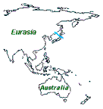
The Japan Sea Geotraverse

MGD77 Format for the Data Records
The data record presents underway marine geophysical data in a correlative manner. Geophysical data (bathymetry, magnetics, and gravity) and seismic identification (shot-point identification) are presented with a corresponding time and position. Documentation that is variable throughout the survey also is included within each data record. If primary navigation exists at a juncture where no geophysical data are present, this record should be included with the data parameter fields left unused (9s filled).
Format Conventions for the Data Record:
     1. All decimal points are implied.

     2. Leading zeros and blanks are equivalent.

     3. Unknown or unused fields are to be 9’s filled.

     4. All "corrections", such as time zone, diurnal magnetics,
     and Eotvos, are understood to be added (e.g., time-zone
     correction is the number of hours which must be added to the
     recorded time to determine GMT).
The following is a detailed description of the Data Record. Fields can be of type integer, real or character. Fields that represent whole numbers are integers Fields that contain a decimal component are real, and fields that are alphanumeric are character.
Character   Length
Nos.        of Field         Type  Description
____________________________________________________________

1           1       int      DATA RECORD TYPE
                             Set to "3" (data record.)

2-9         8       char     SURVEY IDENTIFIER
                             Identifier supplied by the
                             contributing organization, else
                             given by NGDC in a manner which
                             represents the data. Identical to
                             that in header record.


10-14       5       real     TIME-ZONE CORRECTION
                             In hundredths of hours.
                             Corrects time (in characters 15-27)
                             to GMT when added: equals zero when
                             time is GMT.  Timezone normally
                             falls between -13 and +12
                             inclusively.

15-16       2       int      YEAR
                             (e.g. 1972 is represented as 72)

17-18       2       int      MONTH
                             (e.g. May is represented as 05)

19-20       2       int      DAY
                             Day of month

21-22       2       int      HOUR
                             Hour of day

23-27       5       real     MINUTES X 1000

28-35       8       real     LATITUDE X 100000
                             + = North; - = South
                             Between -90 and 90 degrees

36-44       9       real     LONGITUDE X 100000
                             + = East; - = West
                             Between -180 and 180 degrees

45          1       int      POSITION TYPE CODE
                             Indicates how lat/lon was obtained:
                             1 = Observed fix
                             3 = Interpolated
                             9 = Unspecified

46-51       6       real     BATHYMETRY, 2- WAY TRAVELTIME
                             In ten-thousandths of seconds.
                             Corrected for transducer depth and
                             other such corrections, especially
                             in shallow water

52-57       6       real     BATHYMETRY, CORRECTED DEPTH
                             In tenths of meters.

58-59       2       int      BATHYMETRIC CORRECTION CODE
                             This code details the procedure used
                             for determining the sound velocity
                             correction to depth:

                             01-55 Matthews' Zones with zone
                             59    Matthews' Zones, no zone
                             60    S. Kuwahara Formula
                             61    Wilson Formula
                             62    Del Grosso Formula
                             63    Carter's Tables
                             88    Other (see Add. Doc.)
                             99    Unspecified

60          1       int      BATHYMETRIC TYPE CODE
                             Indicates how the bathymetric value
                             was obtained:
                             1 - Observed
                             3 - Interpolated (Header Seq. 12)
                             9 - Unspecified

61-66       6       real     MAGNETICS TOTAL FIELD, 1ST SENSOR
                             In tenths of nanoteslas (gammas).
                             For leading sensor. Use this field
                             for single sensor.

67-72       6       real     MAGNETICS TOTAL FIELD, 2ND SENSOR
                             In tenths of nanoteslas (gammas).
                             For trailing sensor.

73-78       6       real     MAGNETICS RESIDUAL FIELD
                             In tenths of nanoteslas (gammas).
                             The reference field used is in
                             Header Seq. 13.

79          1       int      SENSOR FOR RESIDUAL FIELD
                             1 - 1st or leading sensor
                             2 - 2nd or trailing sensor
                             9 - Unspecified

80-84       5       real     MAGNETICS DIURNAL CORRECTION -
                             In tenths of nanoteslas (gammas).
                             If  9-filled (i.e., set to "+9999"),
                             total and residual fields are
                             assumed to be uncorrected; if used,
                             total and residuals are assumed to
                             have been already corrected.

85-90       6       int      DEPTH/ALTITUDE OF MAGNETICS SENSOR
                             In meters.
                             + = Below sealevel
                             - = Above sealevel

91-97       7       real     OBSERVED GRAVITY
                             In tenths of milligals.
                             Corrected for Eotvos, drift, and
                             tares

98-103      6       real     EOTVOS CORRECTION
                             In tenths of milligals.
                             E = 7.5 V cos(phi) * sin(alpha) +
                             0.0042 V*V

104-108     5       real     FREE-AIR ANOMALY
                             In tenths of milligals.
                             Free-air Anomaly = G(observed) minus
                             G(theoretical)

109-113     5       char     SEISMIC LINE NUMBER
                             Used for cross referencing with
                             seismic data.

114-119    6        char     SEISMIC SHOT-POINT NUMBER

120        1        int      QUALITY CODE FOR NAVIGATION -
                             5 - Suspected, by the contributor
                             6 - Suspected, by the data center
                             9 - No identifiable problem found
                             (NOTE - Institution will most
                             frequently 9-fill this field;
                             however, should they wish to code a
                             "5", the data center will not
                             contradict.  The data center's
                             quality control program, which
                             performs (among other checks) a
                             vectorial analysis of the
                             navigation, is available in a
                             printout form upon request.)
Top of the Document | Marine Geophysical Data | Data Sets | Main Page
URL: http://www.wdcb.ru/sep/traverses/Japan_Geotraverse/MGD77.html2001-2016 © WDC for SEP, GC RAS webmaster