|
|
|
|
2nd Joint Meeting of the IGC/IGeC, Trieste,
Italy, September 5-9 1998.
|
|
|
 |
|
An Integrated Satellite Altimety Data Base and Final
Results of Russian Altimetry Data Processing
|
|
|
| |
|
|
|
This
Document in Format PDF

|
|
|
|
|
|
P.P. Medvedev, S.A. Lebedev, Yu.S. Tyupkin
Geophysical Center Russian Academy of Sciences, Moscow, Russia
V.F. Galazin, D.I. Pleshakov, A.N. Zueva
29 Research Institute of Defense, Moscow, Russia.
The GEOIK program was started in 1985 to obtain a system
of fitted parameters of the Earth (EP-90) including fundamental geodetic
constants, geocentric reference system, and the parameters of the figure
and the gravitational field of the Earth. Initially, this Program caried
out by the Topography Service of the Ministry of Defence of the Russian
Federation and was classified. In 1992 its many parts were declassified,
and altimetry data processed with the application of the fitted parameters
of the Earth (EP-90) were given to the organizations of the Russian Academy
of Science and World Data Centers to be used. The measurements are given
in the form of geophysical data records (GDRs). A huge volume of satellite
altimetry data is disseminated now on optical disks and via INTERNET. The
radar altimetry data of Russian satellites of Geoik series for time interval
1985-1995 is also available to-day for international community. Satellites
of Geoik series were in near circular orbits at an altitude of about 1500
km. Most of these satellites had an inclination of 74 degrees, but some
of them had an inclination of 83 degrees. To make easy for researchers
to use altimetry data obtained by different satellites, the integrated
satellite altimetry database was created in the Geophysical Center of Joint
Institute of the Physics of the Earth. The problem oriented database management
system helps a user to work with data of different satellites (GEOSAT,
ERS, GEOIK, TOPEX/POSEIDON). The special review version of the database
was prepared for on-line access via INTERNET. The estimation of the mean
sea surface and gravity anomalies for World ocean was carried out on the
basis of ten years altimetry data of the Geoik satellites. The results
was compared with the results of similar analysis on the basis of GEOSAT
and TOPEX/POSEIDON data. The work was supported by the Russian Basic Research
Foundation (Project No 96-07-89315).
The Russian geodetic satellite GEOIK carrying a radar altimeter
has been operating since May, 1985. Its main part, satellite GEOIK is one
of the satellies of "Kosmos" series intended for the studies of the Earth
and circumterrestrial space. The satellite is placed on orbit approximately
1500 km high with inclination of 74 or 83 degrees. As of 1996, ten satellites
were launched that were equipped both with radio altimeters (RA) and space-borne
geodetic instruments including Doppler system, radio range system, light
signalling flash system, and laser corner reflectors. Doppler system gives
signals in coherent frequencies of 150 and 400 MHz twelve hours a day to
measure radial velocity; light controlling system produces flashes to photograph
the satellite against the stars; laser corner reflectors of effective area
of 0.024 square meters and relay reflect signals of a ground-based laser
ranger and re-emit signals of ground-based radio ranger.
Ground-based stations measure Doppler radial component of
satellite velocity with respect to the observation station with an error
of 1 - 3 cm/s, determine the satellite position by light flashes with reference
to the stars with an error of 1 - 1.5'', and measure distances to the satellite
by laser and radio rangers with errors of 0.5 - 1 and 1 - 2 m respectively.
A great amount of altimeter data which has geodetic applications
and is important for oceanographic research in the ocean surface topography
and for global meteorological researches has been collected during the
period from 1985 to 1995. The program for accumulating the altimeter data
with GEOIK satellites is planned to be completed at the end of 1996. On
completion of this work, the satellite GEOIK-2 carrying an altimeter one
order of accuracy higher than this one is planned to be launched and this
research will be continued. The program for accumulating the altimeter
data envisaged launching of several satellites (every 2 - 3 years).
Satellites. The satellite is placed on orbit
approximately 1500 km high with inclination of 74 or 83 degrees.
Altimeter data obtained by the satellite and ground-based
stations goes to the Center for Geodetic data processing, where those data
are stored, processed, and used to fulfil the tasks of SGC.
The bulk of scientific results of GEOIK program includes
the model of geopotential of EP-90 up to the 36th degree and EP-200 up
to 200th degree, the improved coordinates of the geodetic network stations,
and the catalog of the geoid heights in the World ocean.
The program has not been completed yet and collecting altimetry
and tracking data by GEOIK is being in progress now. As of May 1996, the
program allowed making 19.3 million measurements from ten satellites. In
fact each satellite operated from several weeks to 18 months. Sometimes
two satellites operated simultaneously, but it was more often that one
satellite was employed. A list of the satellites, characteristics of their
orbits and their operating time are given in Table 1.
Table. 1
Russian Satellite Altimetry Program GEOIK
|
No Satellite
|
Data Launch
|
Inclination,
deg
|
Period of active work
|
Standard deviation,
cm
|
Calibration correction,
m
|
| 1 |
14.06.85 |
73.6 |
08.07.85 - 31.10.86 |
60 |
-17.0 |
| 2 |
11.02.86 |
73.6 |
03.03.86 - 28.03.86 |
140 |
-25.0 |
| 3 |
02.12.86 |
83.6 |
21.12.86 - 15.12.87 |
166 |
-36.5 |
| 4 |
19.02.87 |
73.6 |
09.03.87 - 12.10.87 |
105 |
-26.0 |
| 5 |
30.05.88 |
73.6 |
20.06.88 - 27.07.90 |
88 |
-22.9 |
| 6 |
28.08.89 |
73.6 |
18.09.89 - 26.09.90 |
|
|
| 7 |
30.07.90 |
73.6 |
19.08.90 - 05.03.93 |
|
|
| 8 |
10 01.93 |
73.6 |
10.01.93 - 23.07.93 |
|
-29.79 |
| 9 |
December 1994 |
73.6 |
18.12.94 - 28.07.95 |
|
-25.42 |
Altimeter. Precision of radar altimeter data
(instrument error) ranged from 0.5 to 0.8 m in various spacecrafts. Frequency
of the altimeter 9.5 Ghz (mean square error of measurements adjusted by
one-second interval and by 10-12 second interval is approximately 0.4 -
0.5 m and 0.1 m respectively); Measurements were conducted in steps of
1 measurement a second. The energetic resurce of altimeter is 10h in one
day.
Radio altimetry measurements data were recorded by space-borne
tape-recorders and once a day sent to ground-based stations by telemetric
channels. Deciphering, preliminary processing, calculating of satellite
ephemerides, applying corrections to RA, and calculating sea-level height
were conducted in Computer Center. Space-borne altimeter operated 10 hours
a day and 5 days a week. The work was planned so that maximal uniformity
of covering the World ocean by sub-satellite tracks could be provided.
With several satellites, the criterion that each altimetry orbit was supported
by tracking data was applied. It resulted in excluding altimetry data obtained
in descending orbits across the Atlantic. The bulk of measurements was
conducted in 1-Hz mode. Owing to technological limitations, some errors
in planning, malfunctions, and space-borne equipment failures, the World
ocean appears to be covered by tracking to a large extent nonuniformly.
In processing altimetry data, calculating satellite ephemerides,
applying corrections, calculating sea-level heights were most important.
Working cycle. The program provided that altimeter
measurement were conducted 5 days a week from Monday until Friday, and
on Saturday and Sunday control over serviceability of all spaceborne measurements,
control systems was carried out, and tracking and altimeter measurements
were not conducted.
Service interruptions. Besides the above-mentioned
two-days breaks in accumulating high-precision data other service interruptions
were noted. Some of them were connected with launching new satellites and
subsequent measuring system calibration, and others were due to additional
control overspaceborne systems and restoring the radar altimeter serviceability
by change-over to duplicate facilities of the measuring system.
Records in the CD-ROM contain only high-grade measurements,
therefore some 5-day working cycles are missing.
2. The General Technique of Processing
When preparing altimetry data from GEOIK in GDR formats the
following computation stages have been completed:
- calculations of orbits of the satellites GEOIK provided with
altimeter measurements from tracking data obtained by observation stations
in the area of the former Soviet Union and Antarctic region;
- preliminary processing of radar altimetry data including
corrections for reducing measurements to spacecraft center of mass, instrumental
delays, and tropospheric effects;
- preparation of data in GDR format.
2.1. Calculations of GEOIK Ephemeris
The ephemeris of GEOIK were calculated by 5-day orbits on
the basis of only tracking data obtained by laser, Doppler, photo measurements,
and distance ranging from the space geodetic network stations.
When calculating forces applied to the satellite, the gravitational
field of the Earth, the attraction of the Moon and the Sun, tides in the
solid Earth, light pressure, atmospheric resistance, precessions, nutations,
and poles movements were taken into account.
To calculate orbits the model (EP-90) of gravitational field
of the Earth up to 36th degree was applied. It was obtained by space geodesy
technique, by combining tracking data, including altimetry data, and global
gravimetry and altimetry data on the World ocean presented in catalogs
of 5x5 degrees. Tracking data were used to determine initial conditions
of 16 long (5 days) and 151 short (3 orbits) orbital arcs, geocentric coordinates
of globally distributed network stations, systematic corrections to Doppler,
distance ranging, and altimetry data, elements of mutual transformation
coordinates (reference system of 1942), 167 coefficients of geopotential
expansion by spherical functions most sensitive to the orbits of the given
class. Satellite altimetry measurements (31 5-day orbital arcs) were applied
to improving initial conditions of orbital arcs, the coefficients of the
gravitational field model up to 20th degree, and bias correction to altimetry
data. Catalogs of the heights (1041 blocks) and anomalies (1654 blocks)
were used to improve the model of the gravitational field of the Earth
up to 36th degree. The following parameters of the ellipsoid EP-90 were
obtained:
a = 6378136; b = 1/298, 257839303
The research showed that the error of ephemerides calculations
by radius vector is 1 m on 5-day orbits. The estimate of the radial component
of the error by variations of sea-surface heights in the points where altimetry
tracks cross supports the given value. The nominal accuracy of antenna
orientation is 1 degree.
2.2. Determination of Altimetry Data Sets of Sea Surface Height
Sets of altimetry data on sea surface were formed after satellite
altimetry data were processed. Processing altimetry data was accompanied
by calculating ocean tides and deviations of the quasistationary heights
from the geoid. Taking into consideration low accuracy of the radio altimetry
measurements, the program GEOIK did not include making corrections to the
measured heights of the sea surface for external conditions (tropospheric
and ionospheric corrections, corrections for waves heights and others).
The systematic component of those effects was supposed to be excluded by
bias correction. It should be noted, however, that satellite 6 had space-borne
altimeter which allowed an accuracy of approximately 0.6 m. It is comparable
to the tropospheric effects.
The calculations of the sea surface were made together with
the calculations of correction for sea-tides heights, which was obtained
with the use of Schwiderski's model for 8 main components given for crossing
points with a space of 1 degree. The program for calculating tides heights
includes correction members for effects of long-period tides in the solid
Earth and takes into account loading and self-attraction.
Values of sea-surface heights were calculated in sessions
on 5-days orbital arcs as a difference of the height component of the satellite
ephemerides and altimetry data like corrections and values of the model
heights of the geoid.
To obtain satellite ephemerides the geopotential model (EP-90)
was applied. To calculate geoid heights above the ellipsoid model EP-200
up to the 200th degree was used. To calculate geoid heights above the ellipsoid
the model EP-200 up to the 200th degree was used. It was derived from harmonic
analysis and fitting of the model EP-90 with the catalog of gravity anomalies
established by averaging initial gravity anomalies by 1x1 degree blocks.
Two types of initial data were used to make gravity anomalies
catalog for the World. These data include geoid heights calculated as mean
values of geoid heights by blocks 1x1 degr. from processed GEOIK altimetry
data, and gravity anomalies catalog compiled by the Topography Service
of Russia jointly with Scientific Recearch Institute of Geodesy and Cartography
by use gravimetric observations on land and in the World ocean. To unite
those two types of data a technique for combining radio altimetry and gravimetry
data was elaborated. This technique is based on local approximation of
the gravitational field of the Earth by a system of mass points. Thus,
56840 values of gravity anomalies were obtained.
Nominal accuracy of referring the time to space-borne time
scale is 1 ms. Owing to the elliptical figure of the Earth and the satellite
orbit, the maximal error of sea surface heights calculations caused by
time error is 40 cm.
When using data on differencies of sea-surface heights in
crossing points of altimetry tracks, the time error was estimated for each
5-day altimetry data set. Taking this error into account, we decrease the
mean square error of the differences of sea-surface heights but sufficiently
increase the distribution of error of altimetry data.
2.4. Determination of Bias Correction
Direct bias correction (BC) of altimetry data or determination
of systematic instrumental error (calibration) was not included in the
GEOIK program. Therefore, instrumental error was determined by geodetic
(orbital) technique from errors of closure. It was assumed that in a sufficiently
long interval both altimetry data errors and ephemerides and a priori heights
of the geoid were averaged.
For satellites 1, 5, and 6, bias correction was determined,
while the system of fitted parameters of the Earth (EP-90) was being developed.
They were -17, -25, and -36.5 m respectively. These values are sufficiently
stable in the whole interval of the satellite functioning. However, for
Kosmos 2988 and Kosmos 2037, the spread of errors was not several tens
of decimeters but several tens of meters. It is likely to be related to
switching of subsets of space-borne altimeter and frequency oscillator.
A more accurate BC determination was needed for the above-mentioned two
satellites at the stage of improving ephemerides.
2.5. Determination of BC for Satellite 7
Reference data on failures and switching on board the satellites
were not sufficient to determine changes in work. Therefore, it was necessary
to analyze all the 53 orbital arcs. Jump variations in bias correction
of more than 3 meters allowed us to divide the whole period of its functioning
into 6 parts. Beginning from 03.08.92 sharp changes in BC values are noted.
The formats are given in Table 2. Their content corresponds
to the analog formats of Geosat altimetry data records.
Table. 2
GEOIK EP-90 GDR Format
|
Item
|
Parameter
|
Units
|
Bytes
|
| 1 |
Universal Coordinated Time (UTC) |
sec |
4 |
| 2 |
|
microsec |
4 |
| 3 |
|
microdeg |
4 |
| 4 |
|
microdeg |
4 |
| 5 |
|
cm |
4 |
| 6 |
Sea Surface Height (1-s avg) |
cm |
2 |
| 7 |
|
cm |
2 |
| 8 |
|
cm |
2 |
| 9 |
|
cm |
2 |
| 10 |
Type of surface:
0 - if over water
1 - if over land
2 - if over ice surface
3 - if error of the measurement |
|
2 |
| 11 |
|
|
2 |
|
Total number of bytes
|
32
|
Satellite height H above the Reference System EP-90 ellipsoid
H = Orbit (EP-90) + 100000 (1500 km).
Orbits were computed by adjustment with the use of the least
square method of tracking data from the stations of the former Soviet Union
and Antarctic region. Computations were conducted in the geocentric reference
system "The Earth's parameters of 1990"(EP-90). Values of the semimajor
axis and the general earth ellipsoid in EP-90 system are
a = 6378136, 1/f = 298.25784
Preliminary parameters of the relations between this system
and the system WGS-84, given in [1] are as follows:
dX = 0 dY = 0 dZ = +1.5 m wz = -0.076''.
The accuracy of geocentric coordinates of stations in the
system "The Earth's parameters of 1990" make up 1 - 2 m by latitude, longitude
and altitude for each constituent.
When calculating orbits (ephemeris) by 5-day intervals, the
following factors were taken into account: the Earth gravity field as harmonic
coefficients of expansion in terms of spherical functions up to 36th degree
and the order of geopotential model which is a constituent part of the
earth's geodetic parameters of 1990, gravitational pull of the Sun and
the Moon, atmospheric friction, and light pressure. In addition, to improve
the description of the spacecrafts tracks along with the initial conditions
as Kepler's elements, the parameters of atmospheric friction and light
pressure were improved by one parameter for each of the above-mentioned
factor for each 5-day orbital arc.
The resulting accuracy (mean square errors) of the orbit
computations by 5-day intervals makes up 2 - 3 m for longitudinal constituent,
1 - 2 m for binormal (transverse) constituent, and 0.5 - 1 m for radial
constituent. Likely deviations in the computation values of the marine
topographic surface, caused by orbital errors may reach +/- 2 m by amplitude.
When developing the reference system "Earth parameters of
1995", data on the pole coordinates and corrections UT1-UTC published in
the bulletin "Vsemirnoye vremya" (VNIIFTRI, Russia) were used. Some deviations
from data of the International Earth Rotation Service (IERS) may result
in points coordinates differences which do not exceed 0.5 m, and thus are
within the estimate of geocentric coordinates precision.
Geoid heights included in GDR data are computed with the
use of the geopotential complete model up to the 200th degree and order
which is also included in the geodetic Earth's parameters of 1990 as detailed
characteristics of the Earth's gravity field. Numerical values of these
coefficients have not yet been published.
The earth gravitational field model up to the 200th degree
has been obtained by altimeter and surface gravimetry data. The accuracy
of geoid's heights in the water areas of the world ocean ranges from 0.5
to 1.0 m according to complexity of the gravity field in an individual
region.
6. How to Use This CD-ROMs
CD-ROMs contains the GEOIK altimetry data collected during
July 1985 to July 1995. These data are included on this CD-ROMs in directories
GEOIK_0D where D - satellite number.
Subdirectory DATA - contains the GEOIK altimetry data in
files NNYYMMDD.pc.
Subdirectory IMAGE_1D are included files NNYYMMDD.gif with
images of the ground tracks for 1-day GEOIK orbital arcs.
Directory IMAGE_5D on the second CD-ROM are included files
NNYYMMDD.gif with images of the ground tracks for 5-day GEOIK orbital arcs
of the all satellites.
The GEOIK altimetry data are stored in files, each of which
contains one day of measurements. The naming convention used for the data
files is: NNYYMMDD.pc, where NN is the number of satellite, YY is the year,
MM is the month, DD is the day. The naming convention used for the image
files is:
NNYYMMDD.gif,
where NN is the number of satellite, YY is the year, MM is
the month, DD is the day.
The data in the data files are exactly as the binary (PC)
formatted data.
The directory HTML include hipertext HTM pages: altim_1n.htm,
geoik_0d.htm (where d-satellite number) for quick view ground tracks of
GEOIK satellites by months and half year periods. The pictures include
summary ground tracks, number of records, number of point with measurements
over sea, ice, land and number of bad measurements.
The directory DOC created for documentation and files description.
The directory SOFTWARE include three subdirectories:
SELECT, ARGOS, and VIEW. The program SELECT-1 operates in
the dialogue regime and is intended for rapid selection
of the satellite altimetry data of the GEOIK experiment represented on
the given CD-ROMs. The CD-ROM operations require introduction of the name
of device (for example E). As a result, the file SUB-BAS-1.DAT contains
the supplementary information satisfying the given logic of search: by
time, coordinates and underlying surface. In order to make the logic of
search more complicated, the ARGOS system represented in the given CD ROM
can be used. VIEW_ALT program created for the reading and view altimetry
data with the use monitor only. On line help to program are given by turn
on F1, F2, F3, F4, F8 and F10 keys. Key F8 - indicate satellite number
or residuals about geoid.
Residual = Sea surface height - Instrumental bias
- Tide - Geoid height.
Key F3 give some statistical information about data.
7. Final Results of Processing GEOIK Altimetry Data
Final results include:
-
sea surface height for World ocean (grid 0.25 x 0.25 degree);
-
gravity anomaly for World ocean (grid 0.25 x 0.25 degree);
-
global gravitation field model (PZ-90);
-
study sea level variations for sea around Russia.
-
software and integrated data base.
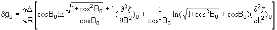
For obtain gravity anomaly we use next formula:
8. How to Get More Information
Technical questions about reading the CD-ROM, the content
of GEOIK GDRs, or scientific applications, should be addressed to WDCB
and NGDC:
Geophysical Center of Russian Academy of Sciences
3, Molodezhnaya Str., Moscow, 117296, Russia,
Petr P. Medvedev E-mail: pmedv@wdcb.ru
Sergey A. Lebedev E-mail: lebedev@wdcb.ru
Tel: +7 (095) 930-5639
Fax: +7 (095) 930-5509
This research was supported by NASA/GSFC/Laboratory of the
Terrestrial Physics and NGDC. Initial interest in carrying out this joint
project was fostered by James Heirtzler of NASA/GSFC. The authors acknowledge
useful discussions with many individuals from NGDC also.
-
The earth's geodetic parameters of 1990, RIO, VTS,
Moscow, 1991, (by Russian).
-
Boikov V.V. et al., Developing geocentric coordinate
system PZ -90, Geodesiya i kartografiya, 17 - 21 pp., 11, 1993, (by
Russian).
-
Cheney Robert E. et al., The complete GEOSAT altimeter
GDR handbook, NOAA Manual NOS NGS 7, october 1991.
-
Galazin V.F. et al., Developing planetary models
of the earth gravity field with the use of
GEOIK, Geodeziya i Kartografiya,
pp. 24 - 27, 11, 1993, (by Russian).
-
Medvedev P.P. et al., Results of Determinations
of Planetary Models and Detailed Characteristics
of Gravity Field With the Use of Satellite Data From
GEOIK, Presented to XXI General Assembly, July
2-14, 1995, Boulder, Colorado.
-
Medvedev P., N. Sergeeva, Yu.Tyupkin Telecommunication
Access to Database of WDC B, Geophysical Center, European Seismological
Commission, General Assembly (25: 1996 Reykjavik), Seismology in Europe,
Papers presented at XXV General Assembly, September 9-14, 1996, Rejkjavik,
Iceland.
-
Medvedev P.P., Heirtzler J.R., Comparisons of the
Geoik, Geosat and ERS satellites altimetry
data over seas around Russia, Annales Geophysicae,
European Geophysical Society, XXII General Assembly, Vienna, 21-25 April
1997, vol. 15, 1997
-
Medvedev P.P., S.A. Lebedev S.A., Yu.S. Tyupkin, An
integrated data base of satellite
altimetry data for fundamentals geosciences research,
ADBIS’97, St. Petersburg, Sept. 2-5, 1997, Proceeding
of the First East-Europpean Symposium on Advances in Databases
and Information Systems, Vol. 2, 1997, 95-96.
© Geophysical Center RAS, 1998
|